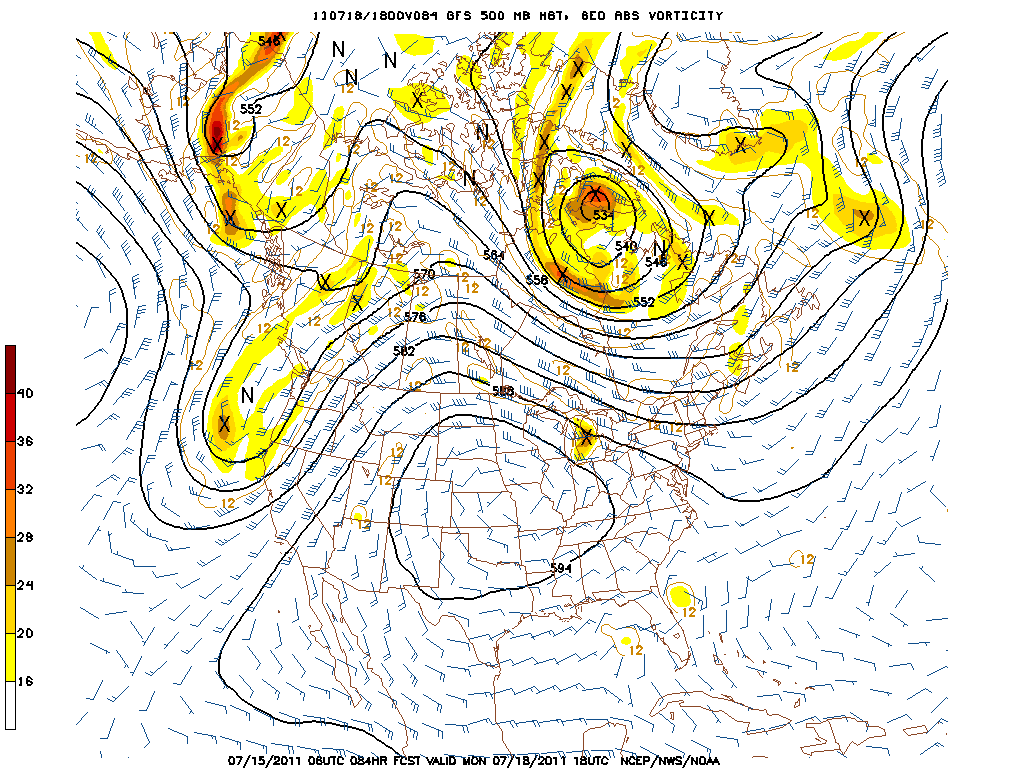
Above is our trusty 500mb chart. This is a set up known as the "Omega Block" because the graph resembles the Greek letter Omega. It is caused by a large ridge of high pressure over the Central U.S. and troughs on either side of the ridge. Under a ridge this big, hot air is sinking to the ground, resulting in scorching temperatures that have brought several days of triple digits. All we are stuck with is cool, gray conditions and some rain this week. That huge ridge blocks systems that typically track north into Canada but are now forced down into our backyard. This Omega Block has been set up for the better part of a week now and things aren't changing a whole lot.
 This map is an anomaly chart that shows the average 500 mb lines from multiple model runs with different starting parameters. It basically gives us a an idea of where ridges and troughs will be 8-14 days in the future. Notice the big ridge over the Central U.S. has subsided a bit but the general trough in the NW/ridge in the East pattern still exists. That's not a welcoming sign for a return to Summer!
 Here is a temperature probability map that correlates with the 500mb map 8-14 days out. I think this is pretty self-explanatory. Blues mean below average, red above. Yadda yadda yadda. Summer appears to be on hold until further notice. Maybe it's time to take a vacation...
No comments:
Post a Comment